|
|
 |
|
|||
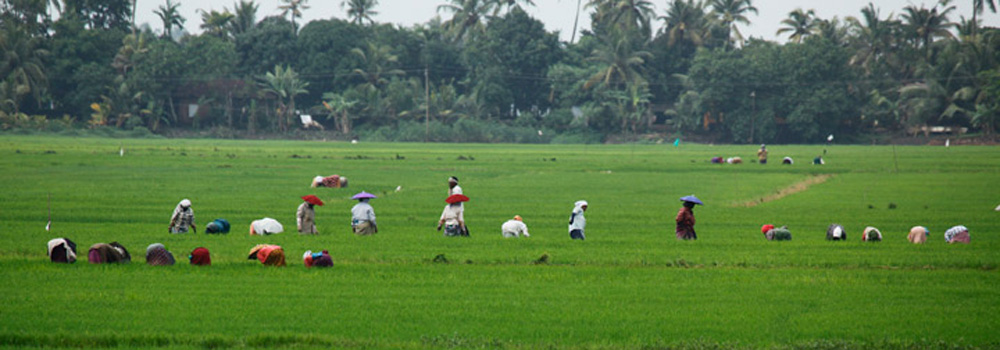
A glimpse of Kerala Kerala ‘Gods own country ‘ which is the gift of the legendary Lord Paraswaram the 6th avatar of Vishnu is situated in the down south of India. He gave order to the sea by throwing his warrier axe in the sea and the sea obeyed his order and the new land”Kerala” was originated from the sea. The name Kerala comes from ‘Keram’ the Malayalam name of a tropical palm tree which produces coconuts. The botanical name of it is cocos nucifera . Geographically this land is divided into three on the basis of height from east i.e highland, midland and coastal region. High Land The eastern side of this land is protected by western ghats with sahia mountain with a height of 2700 mtrs. The high land consists of 48% of the total area of kerala and 600 mtrs. to 2500 mtrs. high from the sea level. The total area comes to 18653 sq. km. The sahia mountain extends from Thapthi river in the north to cape comorin in south. Anamudi the highest peak in western ghats is in kerala which is the highest in south india. Kerala is blessed with 44 rivers and out of it 41 rivers flow to west and 3 rivers flow to east. All rivers originated from the sahia mountain are almost rich in water. Mid land The high land steps down to the mid land, the fertile gifted land with hills and valleys. Midland lies 300 to 600 mtrs. high from sea level. It consist of 41.76% of kerala and comprises of 16230 sq.km in area. All agricultural products except cardamom and tea are cultivated in this region. This area developed with harmonious blendings of virgin culture, hospitality and secularism stands aloft. Coastal region After mid land comes the coastal region without break in the bosom of Arabian sea.This area occupies 10.24% of the total area and it comes to 3979 sq.km. This region is 30 to 300 mtrs. high from the sea level. These areas share the borders of the beautiful backwaters and its interconnected canals which is the speciality of this land. The vembanad lake stretches out her hands and enriches the beauty of these canals and its fabulous shores. In this area, there is a land similar to Holland in the West and this is known as Kuttanad. The innocent and hardworking people in this area whole heartedly welcome the visitors to their Kuttanadu. History of kuttanadu Legends and history linked with the past days of this land. Stories say that once upon a time this land was a sea and its borders share western sides of kottayam and pathanamthitta districts. Three rivers from the western ghats namely Manimala,Pamba and Achankovil joined together in Kuttanad is filled with fresh water in rainy season and in summer due to the inclursion of sea tide filled with salty water. Kuttanad was a shallow seabed of Arabian sea. The lime shell storage in the vembanad lake is an evidence of this legend. In history kuttand is one of the four divisions of Chera kingdom, who once ruled in Kerala. The other divisions are Venad,Karkanad and Puzhinad. Kuttand is now divide into upper kuttanad and lower kuttanad.The eastern side is upper Kuttanad and it is the gateway to hill area.The western side is known as lower Kuttanad. This area is gifted with freshwater lakes,paddy fields,canals,coconut lagoons and variety of birds habitats. The people in the kuttand are mainly agriculturists. The major cultivation is paddy and this land is known as the granary of kerala. The green and golden paddy fields, the canals, the small landscapes in the middle of water and the calm atmosphere with gentle breeze made this land the paradise of kerala. The important attraction in kuttanad is the boat race. Nehru trophy boat race,moolam boat race,paipad boat race,pamba boat race are some of the important boat races.A short over night stay or sitting in a houseboat over the tiny waves of vembanad lake and other smooth flowing rivers and canals exposed to the gentle breeze,experiencing enchanting panoramic views of Kuttanad,enjoying native delicacies expecially the favorite ‘KARIMEEN’ fish, Kuttanadan duck and tapioca preparations,fills evergreen memories in the heart of every tourist who visits this “GODS OWN COUNTRY” History of Alappuzha Alappuzha is known as the Venice of the East . Sri Raja kesavadas the divan of Thiruvithamkur built up this city in 1785. For commercial purpose he built a canal in the city called commercial canal. There is another canal in the city which is called Vadakanal and a canal linked these two canals. There are nine canals in this city . since time immemorial Alappuzha was a centre in the south trade. There was a port in Aalppuzha and the major exports through this port were coir and coir products , spices,coconut and coconut oil. Raja kesavadas built a light house in the Alleppey beach in 1862 and it remains there as a historical monument tiil this day. Forest in kerala Kerala occupies 1442 sq.km dense forests and out of it 350 sq.km lies in Idukki district. Different types of forests in Kerala 1. Wet evergreen forests. 2. Moist deciduous forest. 3. Montane subtropical forests. 4. Semi evergreen forest. 5. Montane sub tropical wet forest. 6. Sandal forests. 7. Dry deciduous forest. Kerala tries its best for the maintenance of an eco-friendly nature. For the existance of this friendly ecosystem and the protection of birds, animals and plants kerala takes much care and concern. Kerala forest areas are divided into three. National parks, wild life sanctuaries and reserve forests. National parks are the most important in the forest areas. National parks and wild life sanctuaries have three parts. They are core , buffer and tourism. The inner forest areas are called core. In this area any types of human contacts are not allowed. For the protection of them the area around them are protected and called buffer. In these two areas tourism is not allowed. The area outside it is Tourism Area. Entry is allowed in this area for public. There are 22 reserve forest in kerala. Eravikulam National Park This is the first national park which situates in Idukki district. This area consists of 97 sq.km and the Nilagiri Tar or Varayad the only forest goats in south India is protected in this area. This area is declared as wild life sanctuary in 1975. Periyar Tiger Reserver This is the first tiger reserve in kerala. It extends about 925 sq.km and spread over Idukki and Pathanamthitta districts. This is the 10th tiger reserver in India. Important wildlife sanctuaries 1. Idukki wild life sanctuaries. 2. Peechi wild life sanctuary 3. Chinnar wildlife sanctuary 4. Waynad wildlife sanctuary 5. Thattekad birds sanctuary 6. Mangalavanam bird sanctuary 7. Neyar wildlife sanctuary 8. Kuringi wild life sanctuary Periyar river |
|
||
|